

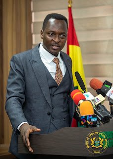
GSSA Boss Warns Developers
.Reoperationalises 7 New Regulations, Upgrades Earthquake Monitoring Network
The Director-General of the Ghana Geological Survey Authority (GGSA), Dr. Prosper Aduah Akaba, has cautioned developers in the Weija–McCarthy Hill areas to obtain expert advice before undertaking any construction, because the lands there are highly earthquake-prone.
Dr. Akaba warned that in the event of any earthquake, residents and buildings in the area would be directly affected.
He explained that Weija and its environs fall within a highly active seismic zone, and that earthquakes occur along fault lines, fault lines which, in that area, are active and moving.
“So, any small trigger can lead to a tremor or an earthquake,” he said.
“The advice is that, as much as possible, they should avoid those places. In the worst case, if they insist on building, they should carry out proper foundation investigations.”
The Director-General disclosed this when he presented the Authority’s achievements and outlook at the Ministry of Lands and Natural Resources’ Progress Series, held at the Ministry’s Conference Hall in Accra on Tuesday, November 17, 2026, under the theme “Accountability, Achievement and Outlook for 2027.”
A major highlight of his presentation was that the GGSA has operationalised seven new legislative instruments to regulate geoscientific activities, strengthen professional standards and improve accountability in the management of geological information and mineral resources.
According to him, the seven regulations came into force on August 26, 2026, after the mandatory 21 parliamentary sitting days, and provide the regulatory framework needed to give practical effect to the Ghana Geological Survey Authority Act, 2016 (Act 928).
He described their passage as a major milestone, noting that although the Authority was established under Act 928 in 2016, it had operated for nearly a decade without the regulations required to fully operationalise its mandate.
The instruments are the Large-Scale Geological Maps Regulations, 2026 (L.I. 2526), Earthquake Monitoring and Seismic Investigations Regulations, 2026 (L.I. 2527), Geological Information and Remote Sensing Agreements Regulations, 2026 (L.I. 2528), Ground Investigation Regulations, 2026 (L.I. 2529) and Geoscientific Standards and Codes of Practice Regulations, 2026 (L.I. 2530);
The rest are Designation of Geoheritage and Geological Heritage Sites Regulations, 2026 (L.I. 2531) and Mineral Resources Exploration to Pre-Feasibility Study Stage Regulations, 2026 (L.I. 2532).
Dr. Akaba said the regulations establish standards for geological mapping, seismic monitoring, ground investigations, geoscientific data management, mineral exploration and the protection of geological heritage sites.
They will, he noted, strengthen regulatory oversight, improve the quality of geological information for national decision-making and enhance revenue generation.
He expressed appreciation to the Minister for Lands and Natural Resources, the Office of the Attorney-General and Parliament for their roles in securing their passage.
Turning to national resilience, the Director-General announced that the modernisation and upgrading of Ghana’s National Seismological Network had been completed and commissioned in June 2026 by the Minister for Lands and Natural Resources.
He recalled that the country’s earthquake monitoring infrastructure had deteriorated badly over the years due to ageing equipment, obsolete satellite communication systems, failed transmission components and outdated data-processing facilities, leaving most remote stations non-functional and dam monitoring stations without real-time data transmission.
The upgrade, he said, has restored real-time seismic transmission and monitoring, modernised dam safety systems and enhanced the country’s capacity for disaster risk reduction.
The Authority, he added, has also conducted seismic hazard assessments across the Ga South, Ga West and Ga North municipalities to support land-use planning.
On diversifying Ghana’s mineral resource base beyond gold, Dr. Akaba said systematic investigations covering about 729 square kilometres had been carried out across Achiase, Akyem Apapam, Yankumasi and surrounding areas in the Eastern and Central Regions, where several pegmatite bodies capable of hosting lithium and tantalum were identified.
Mapping was also undertaken in the Nkusukum area to characterise nepheline syenites and carbonatites useful to the fertiliser, ceramics and glass industries, while soil geochemical sampling at Dambai in the Oti Region revealed elevated values of copper, iron, lead and zinc.
He further revealed that investigations in the Shai-Osudoku area identified about four square kilometres of clay deposits, with an initial estimate of three million metric tonnes, and laboratory analyses are underway to determine their suitability for Limestone Calcined Clay Cement (LC3).
The Authority, he said, has also completed 48 district mineral occurrence maps, although he clarified that these indicate occurrences rather than confirmed resources, and the GGSA remains open to collaboration with investors and district assemblies.
On responsible small-scale mining, he noted that the Authority is being resourced with funding from the Ghana Gold Board and the Mineral Development Fund to explore designated areas and identify mineralised zones, to reduce the environmental destruction associated with poorly informed exploration.
On infrastructure
Dr. Akaba said the renovation of the Bono Regional Office in Sunyani has been completed, while the Eastern Regional Office at Koforidua is 70% complete and expected to be commissioned in December 2026.
He added that the Authority has developed an improved organisational structure with the Public Services Commission, is revising its scheme of service and is working on a 17-year strategic plan.
For 2027, the Authority’s priorities, he outlined, include continuing geological investigations for responsible small-scale mining; intensifying exploration for iron ore, limestone, clay, copper, lead, cobalt, zinc, lithium and columbite-tantalite; sustaining earthquake monitoring and geohazard mapping; expanding the district mineral occurrence maps; and undertaking nationwide sensitisation on the new regulations.
Earlier, the Deputy Minister for Lands and Natural Resources, Alhaji Yusif Sulemana, described the GGSA as one of the most strategic agencies under the Ministry in addressing illegal mining, and commended its role in providing scientific data for national development.